File:Ghana Map.jpg

Size of this preview: 489 × 599 pixels. Other resolutions: 196 × 240 pixels | 392 × 480 pixels | 627 × 768 pixels | 1,060 × 1,298 pixels.
Original file (1,060 × 1,298 pixels, file size: 309 KB, MIME type: image/jpeg)
Summary
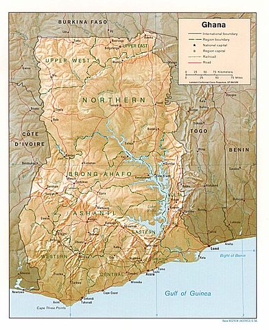
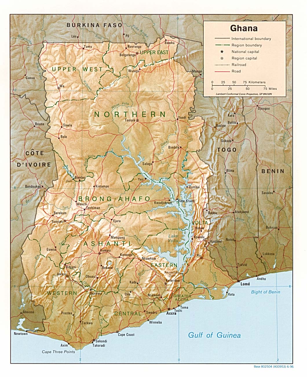
| Description | Shaded relief map of Ghana, 1996, produced by the U.S. Central Intelligence Agency. |
| Date | |
| Source | University of Texas Libraries, Perry-Castañeda Library Map Collection: Ghana maps |
| Author | CIA |
Licensing
| This image is a work of a Central Intelligence Agency employee, taken or made as part of that person's official duties. As a Work of the United States Government, this image or media is in the public domain in the United States.
|

|
File history
Click on a date/time to view the file as it appeared at that time.
| Date/Time | Thumbnail | Dimensions | User | Comment | |
|---|---|---|---|---|---|
| current | 20:46, 3 August 2006 | | 1,060 × 1,298 (309 KB) | wikimediacommons>DO11.10 | Shaded relief map of Ghana. Image source: [http://www.lib.utexas.edu/maps/africa/ghana_rel95.jpg], from the [http://www.lib.utexas.edu/maps/ghana.html Perry-Castañeda Library Map Collection]. {{PD-USGov-CIA}} Category:Maps of Ghana |
File usage
The following page uses this file: